[{"id":20332478505,"handle":"500-piece-puzzles","updated_at":"2024-04-08T05:20:02-04:00","published_at":"2018-03-01T13:37:14-05:00","sort_order":"manual","template_suffix":null,"published_scope":"global","title":"500 Piece Puzzles","body_html":"\u003ch3\u003eWe make all of our 500 piece jigsaw puzzles at the Michigan History Center on a large industrial puzzle cutter. The images are from the historical collections of the Archives of Michigan.\u003c\/h3\u003e"},{"id":2700182,"handle":"frontpage","updated_at":"2024-04-08T05:20:02-04:00","published_at":"2010-10-20T09:40:10-04:00","sort_order":"manual","template_suffix":null,"published_scope":"global","title":"Frontpage","body_html":null},{"id":372022599,"handle":"new-items","updated_at":"2024-04-08T05:20:02-04:00","published_at":"2016-08-26T12:25:00-04:00","sort_order":"manual","template_suffix":"","published_scope":"global","title":"New items","body_html":"\u003cblockquote\u003e\n\u003ch3\u003eNew items from Michiganology\u003c\/h3\u003e\n\u003c\/blockquote\u003e"},{"id":8769404,"handle":"puzzles","title":"Puzzles","updated_at":"2024-04-08T05:20:02-04:00","body_html":"\u003ch3 style=\"text-align: center;\"\u003e\u003cstrong\u003eWe make our jigsaw puzzles at the Michigan History Center on a large industrial puzzle cutter. The images are from the historical collections of the Archives of Michigan.\u003c\/strong\u003e\u003c\/h3\u003e","published_at":"2012-12-18T10:42:37-05:00","sort_order":"best-selling","template_suffix":"","disjunctive":false,"rules":[{"column":"title","relation":"contains","condition":"Puzzle"}],"published_scope":"global","image":{"created_at":"2013-03-06T14:59:25-05:00","alt":null,"width":460,"height":320,"src":"\/\/shop.michiganology.org\/cdn\/shop\/collections\/store-collection-puzzles.png?v=1362599965"}}]
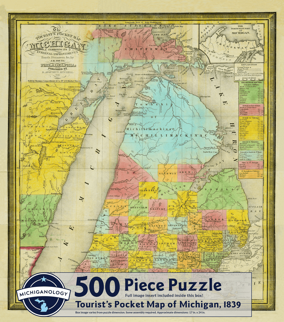
This 1839 "Tourist's Pocket Map of Michigan" once exhibited more than internal improvements, roads and distances. First published by S. Augustus Mitchell in 1834, the map went through a variety of changes from its original publication date to 1846. It was called a "Tourist's Pocket Map" as a result of its literal function. It could be folded into a small 12x7.5-inch booklet that could fit into any tourist's pocket; the original is 18x22 inches.
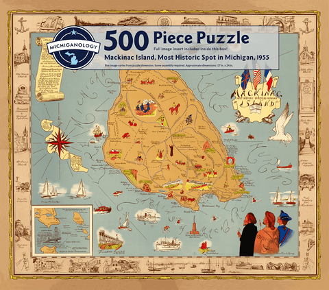
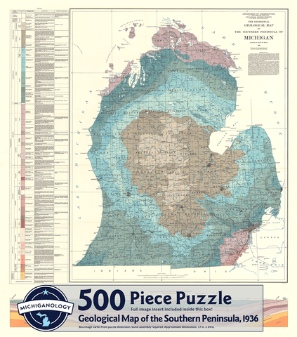
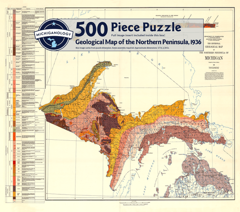
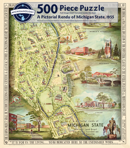
Features a historical image from the collections at the Archives of Michigan. This 500-piece jigsaw puzzle is printed, pressed, and assembled in Lansing, Michigan. Approximate dimensions are 17" x 24"
*Disclaimer: This puzzle is hand-pressed by a Michiganology team member. Therefore, each puzzle comes out differently and will not fully match the image on the puzzle's box.*